
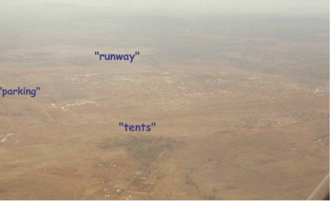
1968. Looking South. High air view of Camp Enari,
1968. Above "tents" are the troop hqs and
tents. The dark area right of "parking" is 17
Cav helipads. The Sqdn HQ is the white buildings right of
"parking" and below dark area.
"runway" is 4th Div airstrip. Vietnamese
village is below "tents". Dragon Mountain is
out of picture to the right. (Bob Young Photo)
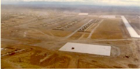
1968. Looking East. Landing to the East at
4th Div
East-West runway. Div helicopter parking and refueling.
17 Cav is top center of picture at edge of camp. (Bob
Young Photo)
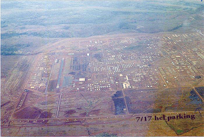 1968. Looking West. 4th Div airstrip on left.
Squadron helicopters are parked in the dark area above "7/17
helicopter parking". Squadron maintenance is to the right and
out of picture. The white boxes along the road at bottom
are bunkers and mark the fence and edge of camp. Dragon
Mountain is out of picture at top right, beyond dump
smoke. (Bob Young Photo)
1968. Looking West. 4th Div airstrip on left.
Squadron helicopters are parked in the dark area above "7/17
helicopter parking". Squadron maintenance is to the right and
out of picture. The white boxes along the road at bottom
are bunkers and mark the fence and edge of camp. Dragon
Mountain is out of picture at top right, beyond dump
smoke. (Bob Young Photo)
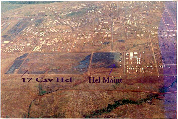
1968. Looking West. Sqdn helicopter parking is above
"17 Cav Hel". Sqdn maintenance is above
"Hel Maint". Sqdn HQ is in the white buildings
to the right of "Hel Maint". Black coating was
put on the sand to reduce dust and maintenance. The troop
areas are just out of picture to the right. (Bob Young
Photo)
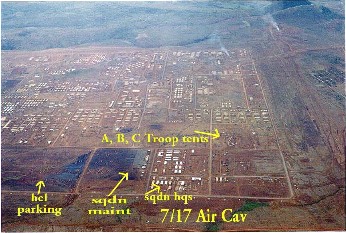
1968. Looking West. The yellow notes pretty much tell
the story. You might say we lived on the edge. I remember
the night of TET 68 and manning the M60 on the fence to
the right. Right beside the rest of you. Feb 68. Dragon
Mountain is in view in top right corner beyond the dump
smoke. (Bob Young Photo)
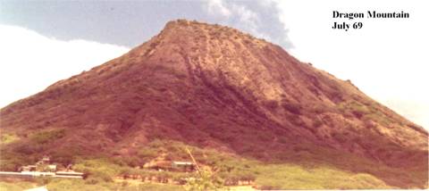 1969. Dragon
Mountain is located at the Northeast corner of Camp Enari. It could be seen from a great distance by the air
crews and was a major navigation reference point. (Mike
McCarthy Photo)
1969. Dragon
Mountain is located at the Northeast corner of Camp Enari. It could be seen from a great distance by the air
crews and was a major navigation reference point. (Mike
McCarthy Photo)
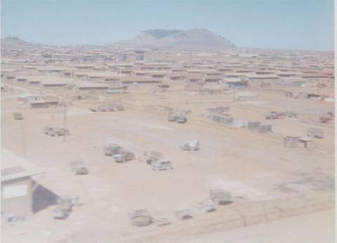
1969.
Dragon Mountain as seen from inside Camp Enari. (Jim
Littlejohn Photo)
Return to HHT
Gallop To Squadron Headquarters
Email: Bob Young